UK Street Insight
UK Street Insight app icon

UK Street Insight

Crime Map, Compare & Reports

Search any UK postcode, street or address for official police crime data, explore area stats and trends, compare different areas side by side, save crimes and crime locations to follow them over time, and export full PDF reports.

Free for iPhone and Android

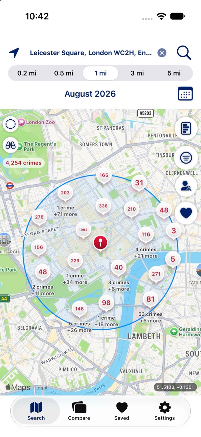
Crime map around Leicester Square, London, showing 4,254 crimes clustered within a 1 mile radius for August 2026

Know a neighbourhood before you move in

Built for home buyers, renters and travellers. Every search uses real monthly police records for England, Wales and Northern Ireland from the official Police API, not a third-party estimate.

Check a street before you buy or rent, compare neighbourhoods you’re choosing between, pick a hotel area for a trip, or keep an eye on your own area month after month.

Most features are the same on iPhone and Android. Look Around and street and address search with live suggestions are iPhone only.

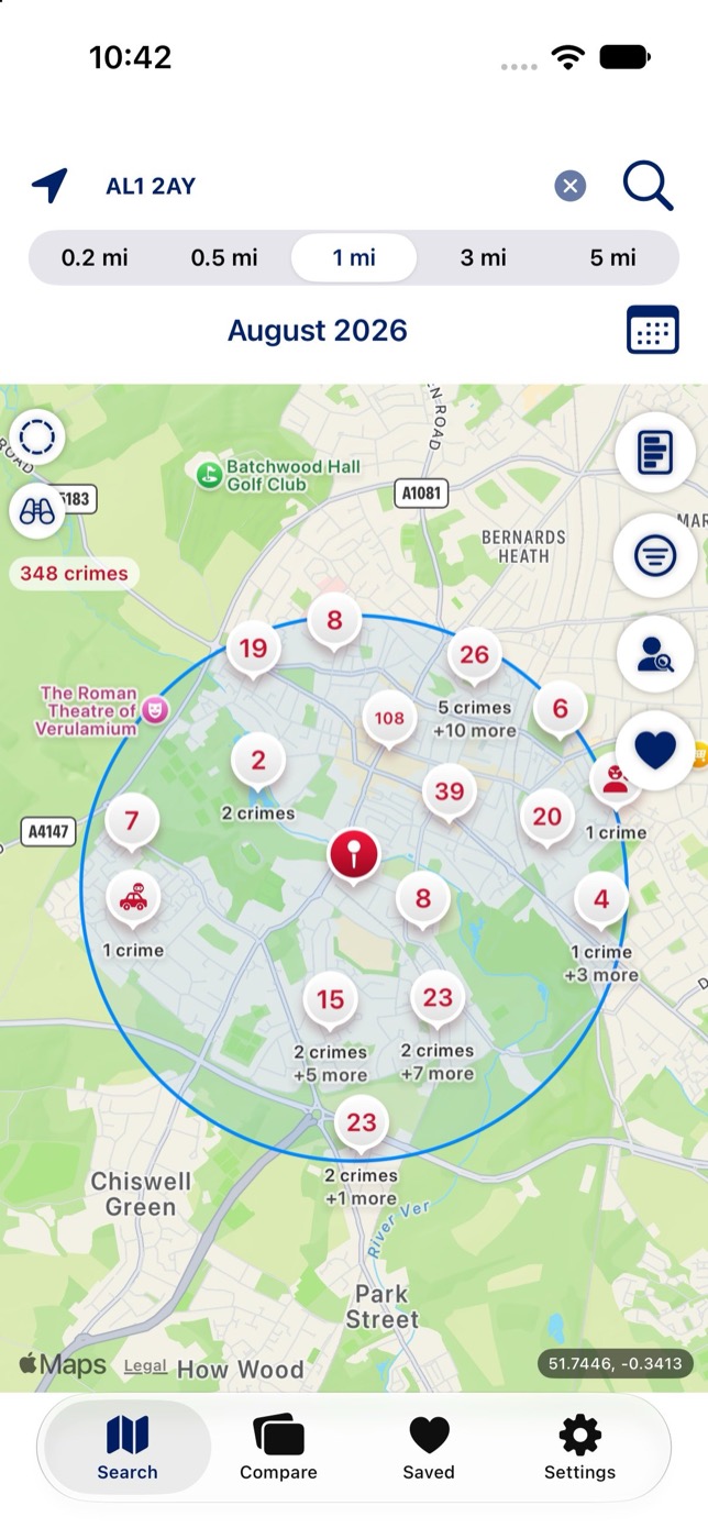
Crime map for postcode AL1 2AY showing 348 crimes within 1 mile

Crime map

See what’s been reported nearby

  • Search by postcode, coordinates, or your current location. On iPhone you can also search by street or address with live suggestions. You can also pan the map and tap “Search here”
  • Choose a radius of 0.2, 0.5, 1, 3 or 5 miles, and preview the area before you search
  • Pick the newest month, a preset range (3, 6, 12, 18 or 24 months), or a custom period up to 24 months, or swipe to step month by month
  • Crimes are clustered and split apart as you zoom in
  • Filter the map by crime category
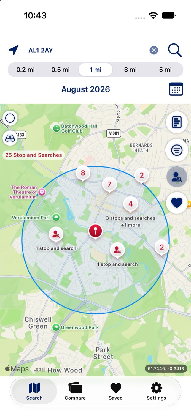
Stop and search map layer showing 25 stop and searches near AL1 2AY

Stop and search

A separate layer, one tap away

Switch the map to stop and search records. You can see the type, object of search, legislation, outcome and, where recorded, demographics, exactly as published. These records are never linked to any crime record.

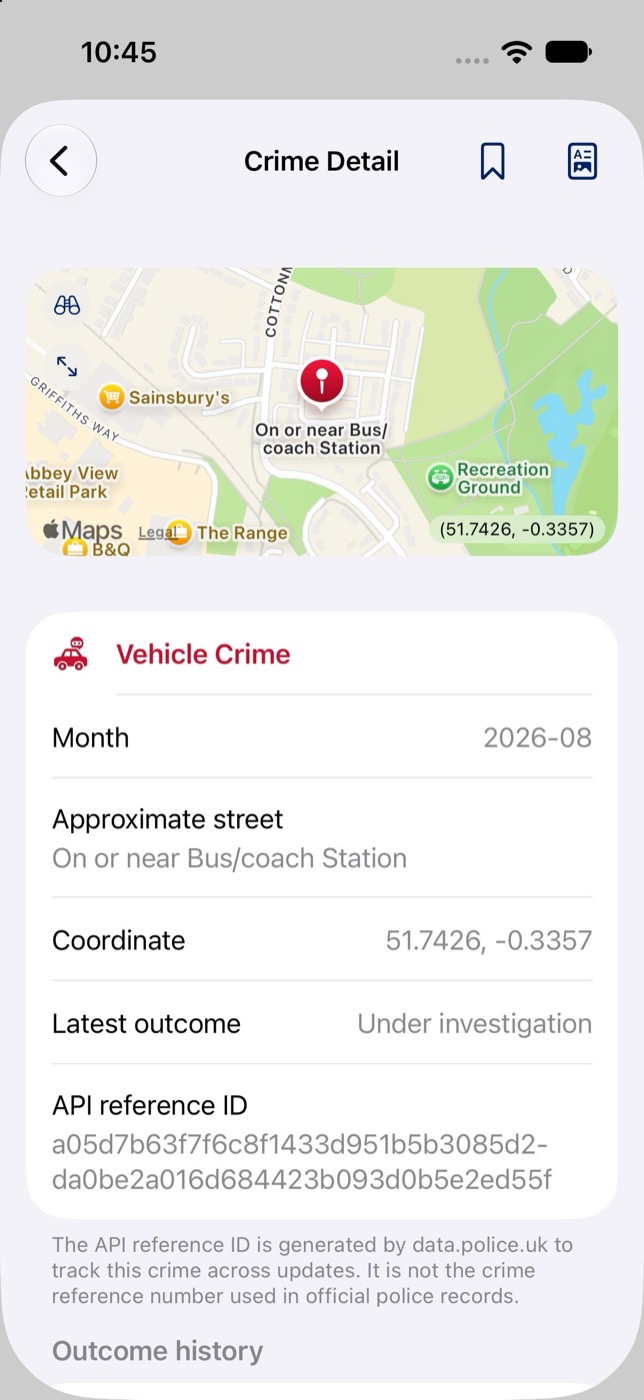
Crime detail for a vehicle crime, showing month, approximate street, coordinate and latest outcome

Crime detail

Every crime, with its outcome history

Tap any point to see the individual crimes recorded there, then tap through for the category, month, approximate location and full outcome history.

Save a crime and check for a newer outcome whenever you like.

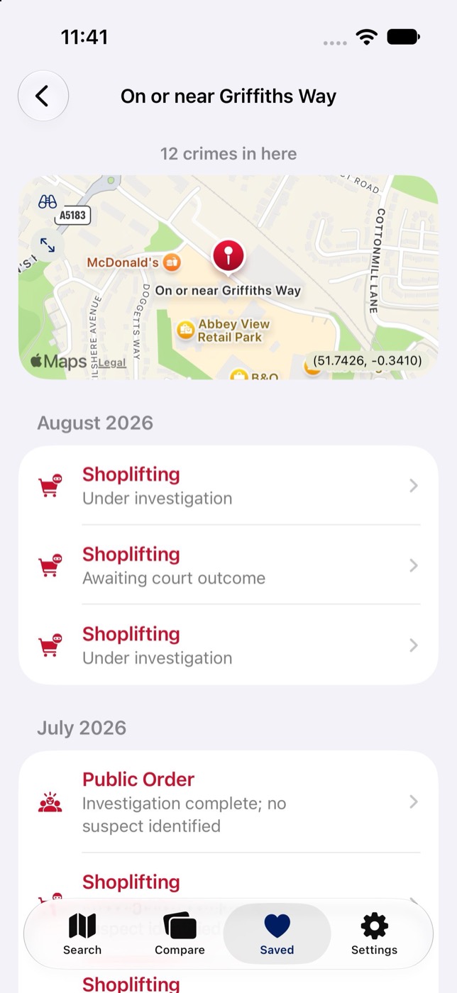
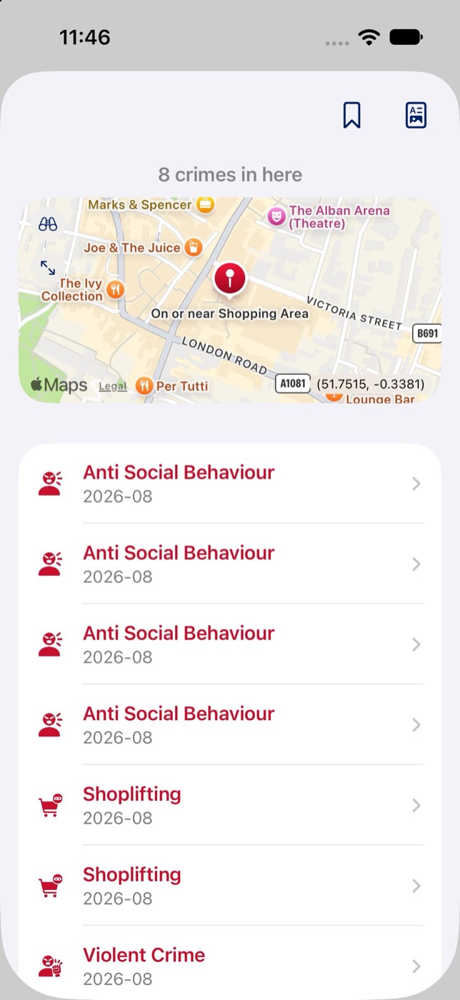
Saved crime location On or near Griffiths Way, with its crimes grouped by month and each crime’s outcome

Saved crime locations

Watch a spot over time

Save any crime location on the map, such as a station, car park or shopping area, and come back to it whenever you like.

  • Fetch every crime recorded at that exact point for up to the past 24 months
  • Crimes are grouped by month, with each one’s latest outcome
  • See at a glance whether a spot is getting quieter or busier
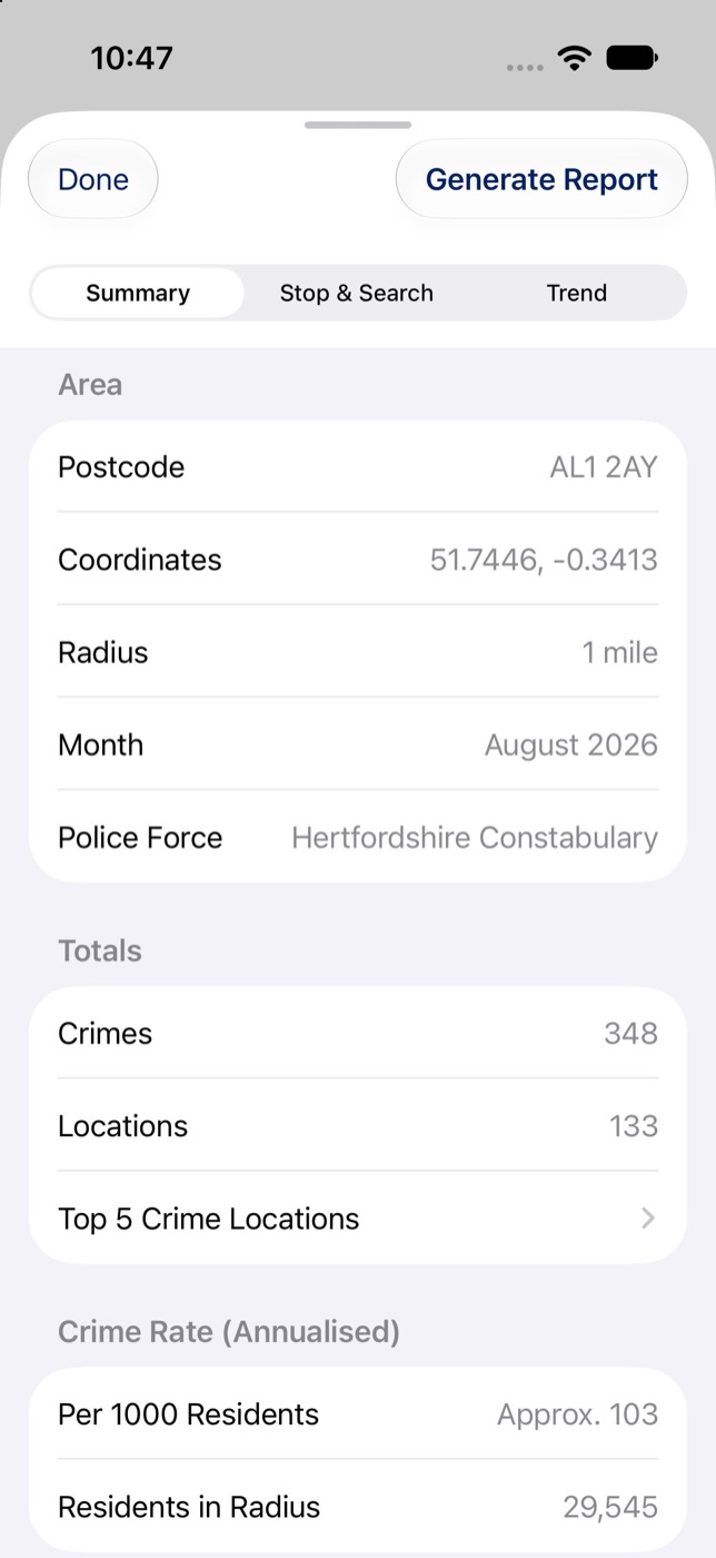
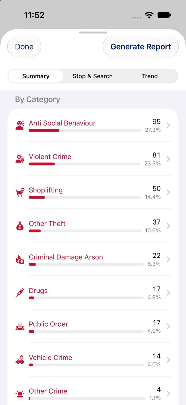
Area summary showing 348 crimes, 133 locations and an annualised crime rate of about 103 per 1,000 residents

Area stats

Context, not just a count

  • Category breakdowns and the top 5 busiest crime locations for any search, plus the top 3 for each category
  • An estimated crime rate per 1,000 residents, based on 2021 Census population data
  • An annualised rate for shorter search windows
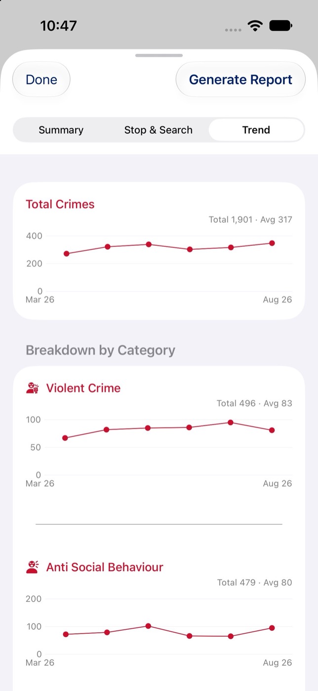
Trend charts showing total crimes and violent crime month by month from March to August 2026

Trends

Is it getting better or worse?

Month-by-month trend charts for total crime and each category, so you can spot a one-off spike or a steady change. You can choose how many months the Trend view shows by default.

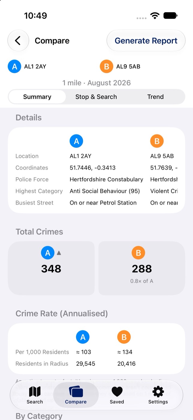
Comparison of postcodes AL1 2AY and AL9 5AB showing total crimes and crime rate side by side

Compare areas

Compare different areas side by side

  • Add each area by postcode, address, coordinates, a saved location or a point picked on the map
  • One shared radius and time period for a fair comparison
  • Total crime counts, category breakdowns by count or share, and monthly trend lines (raw or indexed)
  • Stop and search patterns for each area
  • The labels stay fixed as you scroll, so even a busy comparison stays easy to read
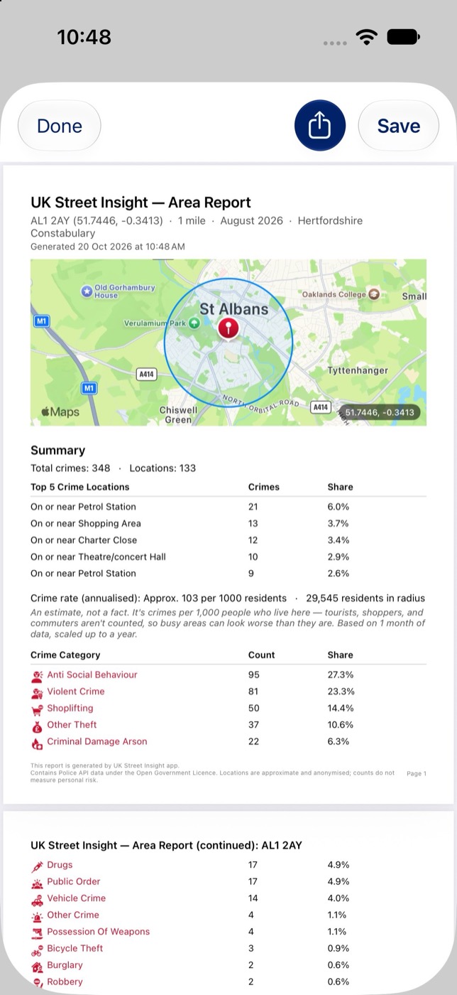
PDF area report for AL1 2AY with a map, summary and crime category table

PDF reports

Share a complete report in one tap

Create a full report for a search, with the summary, top crime locations, stop and search and trends together. Every page includes a map image and the official licence attribution.

You can also create reports for a comparison, a single crime or a single crime location, and preview each one in the app before you save or share it.
And there’s more

Look Around

iPhone only. See street-level imagery for any spot on the map, or for any crime location, then open it full screen to explore the street (where Apple Maps has coverage).

Save & follow up

Save postcodes, addresses or map locations with your own chosen radius, all kept together in the Saved tab. Arrange your saved crimes, locations and reports in the order you like.

Search history

Your recent searches are kept in History automatically. Tap one to run it again, or save it to your locations.

Reports library

Every saved PDF report is kept in your own Reports library, ready to view, share or delete, one at a time or all at once.

Handy touches

  • Tap any coordinate to copy it
  • Enlarge any detail map for a closer look

Police force directory

Look up any UK police force’s contact details, online channels and neighbourhood teams, and see which force covers the area you searched.

Known limits, shown honestly

  • Crime locations are anonymised to the nearest map point
  • No crime data for Scotland, as Police Scotland doesn’t publish to data.police.uk
  • Greater Manchester Police hasn’t published data since early 2025
  • No stop and search or outcome data for Northern Ireland
  • The crime rate is an estimate, not a measured statistic

Screenshots

Scroll sideways to see more.

Your data stays on your device

No account, no sign-up and no backend server. Your search history, saved locations, saved crimes and reports are stored on your device. The app only connects to the official Police API, to fetch crime data, and to your phone’s map service (Apple Maps on iPhone, Google Maps on Android) to show maps and find a postcode or address.

Read the full privacy policy →

Check your street today

UK Street Insight is available for iPhone and Android.